The Core Challenges Facing Deep Mineral Exploration Today
Locating mineral deposits at significant depth has always demanded a difficult trade-off between accuracy, speed, and cost. Traditional manual drilling remains labor-intensive and expensive, while conventional single-channel electrical surveys are slow and struggle to deliver reliable three-dimensional subsurface data. In high-interference field environments, data quality often suffers, complicating decision-making for mining and energy operators. These are precisely the industry pain points that Geomative Co., Ltd., a Shenzhen-headquartered international provider of geophysical exploration equipment and services, was built to address.
Geomative operates under a strategic positioning it describes as "Geophysics+," a concept that integrates high-precision hardware with cloud-based digital platforms. The company has been recognized as a Specialized, Refined, Differentiated, and Innovative (SRDI) SME, and holds National High-Tech Enterprise certification alongside ISO9001 and CE certifications. With exports to more than 40 countries and regions—including India, Southeast Asia, and Central Asia—and a service base exceeding 1,000 clients across more than 100 industry applications, the company's footprint spans mining (gold, iron, copper), environmental engineering, hydrogeology, civil engineering, and archaeology.
Multichannel Electrical Resistivity Systems Built for Field Efficiency
At the center of Geomative's mineral exploration toolkit is its line of electrical resistivity systems, positioned for high-efficiency subsurface mapping across geological, environmental, and engineering applications.
GD-20: Multichannel Acquisition and 3D ERT
The GD-20 multichannel electrical resistivity system was designed to solve the inefficiency of single-channel acquisition and the complexity of processing three-dimensional data. Its independent 5- or 12-channel architecture supports acquisition through up to 10 ERT measurement channels. According to Geomative, the multichannel system can increase average testing efficiency by approximately two to three times compared with single-channel equipment, allowing exploration teams to cover more ground in less time. The system supports advanced 3D ERT modules for three-dimensional electrical resistivity tomography, and it offers high-power IP mid-gradient cross-sectional profiling—an industry-first capability for induced polarization surveys that is particularly relevant to mineral prospecting, where IP anomalies may be associated with sulfide mineralization.
GD-10 and GD-10 Supreme+: From Standard Sounding to Subsurface Mapping
For teams requiring simpler, single-channel operation, the GD-10 supports both 1D vertical electrical sounding (VES) and 2D electrical resistivity imaging (ERI), offering flexibility for varied field applications. The GD-10 Supreme+ was used in a groundwater investigation in India’s Morena District to characterize subsurface conditions in hilly terrain. No major aquifer system was identified within approximately 150m. Based on surrounding hydrogeological conditions, the project team considered that a confined aquifer might occur at greater depth. The case demonstrates the system’s usefulness for subsurface mapping, while deeper targets still require geological assessment and drilling verification.
Power Infrastructure for High-Power Induced Polarization Surveys
Deep mineral exploration, particularly large-scale induced polarization surveys, requires substantial and stable power delivery. Geomative's geophysical power supply line—BP-150, BP-300, BP-450, and GP-5000—is built around this requirement. The BP-150 integrates lead-acid batteries for portability along with protection mechanisms against short-circuits and overheating. The BP-300 delivers voltage options of 50V, 100V, 150V, and 300V for standard surveys, while the BP-450 supports up to 150V, 300V, and 450V with 450W capacity for deep-strata exploration needs. At the top of the range, the GP-5000 offers 5000W capability, purpose-built for large-scale industrial induced polarization applications where power availability often becomes the limiting factor in survey depth and resolution.
Deep-Strata Technical Metrics and Complementary Instrumentation
Geomative’s technical specifications include multichannel acquisition through up to 10 ERT measurement channels in the GD-20 system. Within the company’s broader exploration portfolio, the GT-10 Mineral transient electromagnetic system is specified for investigation ranges of approximately 30m to 1,300m. This TEM capability should be considered complementary to GD-series resistivity and IP surveys, rather than a depth specification for the GD-20.
Complementing the resistivity line is the GPM-10 high-precision proton magnetometer, which uses high-accuracy crystal oscillators (OCXO) for superior data synchronization and integrates GPS/GNSS for automatic location tagging—addressing the low data resolution and synchronization issues common in magnetic surveys used in mineral and archaeological work.
For scenarios requiring rapid electromagnetic assessment, Geomative also offers the GT10 and GT20 transient electromagnetic (TEM) systems. The GT10 combines receiver, transmitter, and power supply into a single portable "one-box" unit, solving the logistical complexity of transporting separate components across rugged terrain. The GT20 is built for advanced TEM exploration, streamlining electromagnetic surveys in non-coal mine roadways and tunnels where rapid geological prediction is essential.
Managing and Modeling Data Through Integrated Software
Hardware alone cannot solve the data management challenges that come with large-scale exploration campaigns. Geomative Studio supports survey-script configuration, field-data review, quality control, and data export for GD-series resistivity and IP surveys. Subsequent inversion, modeling, and geological interpretation may require compatible specialist software and professional analysis.
For continuous monitoring applications, according to Geomative’s latest product information, the DIGspace Geo-3D Platform supports cloud-based data aggregation, visualization, and online-monitoring workflows. This platform connects field sensors to a centralized cloud dashboard and can support early-warning workflows for applications such as dam seepage and landfill leachate tracking, as well as broader real-time environmental and site-monitoring needs.
Proprietary Technology and Research Foundation
Geomative's exploration equipment is underpinned by a patented Segmented Centralized High-Density Electrical Method, developed as proprietary R&D. The company has also participated in the National Key R&D Program for subsurface environmental spatial information management and remains an active participant in the China Geoscience Union Symposium, reflecting ongoing engagement with the broader geoscience research community.
Demonstrated Field Applications
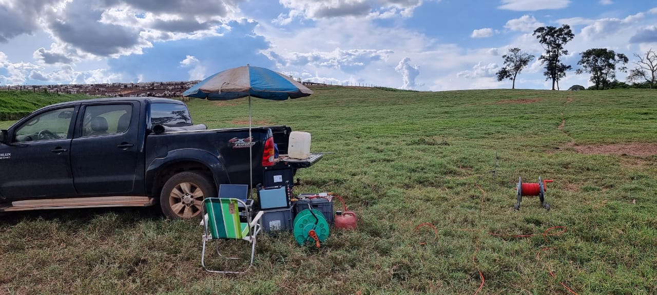
Beyond mineral-specific deployments, Geomative's methods have been validated across a range of field conditions. An oil pollution investigation at a chemical factory site used an ERT survey with a Wenner-Schlumberger array to delineate 1,287 m² of contamination reaching a depth of 12m. In the Philippines, VES surveys identified three priority drilling areas and provided indicative drilling-depth recommendations for a rural water-supply project in Quezon. Final aquifer yield and sustainable discharge still required verification through drilling and pumping tests. At the Wuta Temple site in Beijing, the company's proprietary high-density electrical method successfully identified hidden underground cavities without excavation. While these cases span environmental, hydrogeological, and archaeological contexts, they collectively demonstrate the same core resistivity and data-processing technologies that Geomative applies to deep mineral exploration.
A Practical Path Forward for Exploration Teams
For organizations evaluating deep mineral exploration equipment, the combination of multichannel acquisition, high-power induced polarization support, deep-strata reach up to 1,300m, and integrated cloud-based data modeling represents a coherent, end-to-end approach rather than a collection of disconnected tools. Geomative's global service scale—more than 1,000 clients across over 40 countries—together with its SRDI designation, National High-Tech Enterprise certification, ISO9001 and CE certifications, offers exploration teams a documented basis for evaluating equipment reliability and support infrastructure. As mineral exploration continues to push toward greater depths and more complex terrains, integrated solutions that pair field-tested hardware with cloud-based inversion modeling, such as those offered by Geomative Co., Ltd., are becoming a practical reference point for teams seeking to improve field efficiency without compromising data reliability.
https://www.geomative.com
Geomative Co., Ltd.
About Author